Territorial Development of the United States
1885 Color Map
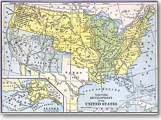
The longitude is, or course, measured from Washington. This old map shows all the territories (even "Indian Territory" that later became the USA. The map is in very good condition with no discoloration or other damage except for one tiny fox spot in the Atlantic Ocean. It is creased in the middle. It is on heavy paper, and is blank on the reverse. The margins are bigger than shown here, the print being 10 inches by 8 inches; the image area is 8-1/2 inches by 6 inches. Your satisfaction is guaranteed.
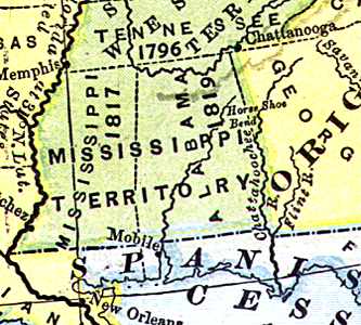
View a detail of this print.